
Drachselsried
You can help expand this article with text translated from the corresponding article in German. (March 2009) Click [show] for important translation instructions.
|
Drachselsried | |
|---|---|
 Drachselsried | |
 Coat of arms | |
Location of Drachselsried
within Regen district 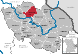 | |
 Drachselsried  Drachselsried | |
| Coordinates: 49°6′N 13°1′E / 49.100°N 13.017°E | |
| Country | Germany |
| State | Bavaria |
| Admin. region | Niederbayern |
| District | Regen |
| Government | |
| • Mayor (2020–26) | Johannes Vogl[1] (CSU) |
| Area | |
• Total | 41.73 km2 (16.11 sq mi) |
| Highest elevation | 1,284 m (4,213 ft) |
| Lowest elevation | 435 m (1,427 ft) |
| Population (2023-12-31)[2] | |
• Total | 2,440 |
| • Density | 58/km2 (150/sq mi) |
| Time zone | UTC+01:00 (CET) |
| • Summer (DST) | UTC+02:00 (CEST) |
| Postal codes | 94256 |
| Dialling codes | 09945 |
| Vehicle registration | REG |
| Website | www |
Drachselsried is a municipality in the district of Regen, in Bavaria, Germany. Drachselsried is in the Zeller Valley (German: Zellertal), and is part of the Glass Road (Glasstrasse) The area is part of the Bavarian Forest National Park. The village is a small, highly organised, friendly place to live. Bayern Eins, the German radio station, gave some history details of the village, which was first noted in 1184. The village continues to grow with the addition in 2017 of a retirement home with private apartments, close to the village centre. A number of new homes have been built on land available for purchase from the local council.
References
[edit]- ^ Liste der ersten Bürgermeister/Oberbürgermeister in kreisangehörigen Gemeinden, Bayerisches Landesamt für Statistik, 15 July 2021.
- ^ Genesis Online-Datenbank des Bayerischen Landesamtes für Statistik Tabelle 12411-003r Fortschreibung des Bevölkerungsstandes: Gemeinden, Stichtag (Einwohnerzahlen auf Grundlage des Zensus 2011).
External links
[edit]- https://www.drachselsried.eu Archived 2022-01-17 at the Wayback Machine
Towns and municipalities in Regen (district) | ||
|---|---|---|
 | ||
| International | |
|---|---|
| National | |
This Regen district location article is a stub. You can help Wikipedia by expanding it. |